GET-YUR-MOTOR-RUNNIN' ROAD TRIP
(Astoria - Santa Fe - Death Valley - Astoria)
Day Trip to South Lake, CA
November 20, 2013 (Day 37 of 44)
Miles Today: 51 / Trip Miles: 4,046

Click on Map to Make Larger
Photos:
Click on photo for a larger image.
All photos © 2014 Leon Jackson. All Rights Reserved.
Into The High Sierras:
Bishop sits at an elevation of 4,200 feet, at the base of the High Sierras. Mid-day temperatures were warm—in the mid-60s F. Sierra Nevada views from Bishop are as good as the views from Lone Pine, or better. Relying on a suggestion from a barber who gave me a haircut in Bishop, I took California Highway 168 east into the Sierra Nevada, heading for Lake Sabrina. The highway climbs quickly (5-percent grade) through arid terrain and enters Inyo National Forest. Elevation signs for 6,000 ft , 7,000 ft and 8,000 ft zip by. Aspendale, at 8,500 feet, is a small vacation home community. Highway 168 was closed just past Aspendale, so I turned around. After a few miles heading east on CA-168, I turned onto South Lake Road.
South Lake Road:
This narrow and winding road heads southwest, and ends at South Lake. The highway follows the South Fork of Bishop Creek, through some deep canyons along the route. A serious road sign warned: "Avalanche Area No Stopping - No Pedestrians". The forest was mostly barren deciduous trees, with some scattered evergreens. There was snow on the ground, but the road was clear.

Winter Approaching
Barren trees and cold temperatures along South Lake Road as winter approaches. I think the trees are Aspens … anyone know for sure?
[flickr]
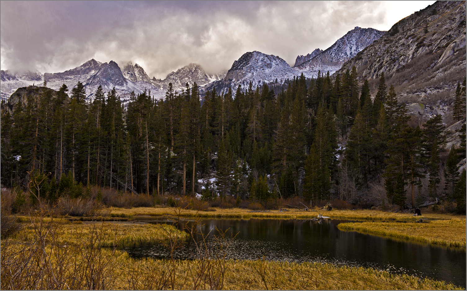 Storm Clouds over Eastern Sierras
Storm clouds over Weir Pond in the Eastern Sierras. Located southwest of Bishop, along South Lake Road, Weir Pond is fed by the South Fork of Bishop Creek. Look closely for Big Foot foraging for food next to the pond.
[flickr]
 Snow Storm Over Sierras
South Lake (a reservoir) is at record low levels. The mountain peaks in the background are over 13,000 feet high. Note the steel bars embedded in the rock that were used during construction of the dam.
[flickr]
 Rusty Rivets
Rusty rivets on an old, abandoned boiler used by a saw mill once located near the South Lake Dam.
[flickr]
 Winter Is On Its Way
Cold winter colors along South Lake Road. Pre-winter cold weather has drained color from the landscape. Overcast skies have heightened the effect—winter is on its way.
[flickr]
[flickr]
Storm clouds over Weir Pond in the Eastern Sierras. Located southwest of Bishop, along South Lake Road, Weir Pond is fed by the South Fork of Bishop Creek. Look closely for Big Foot foraging for food next to the pond.
[flickr]
South Lake:
In 1909, the Nevada-California Power Company finished construction of the South Lake Dam (elevation 9,800 feet). Southern California Edison (SCE) now manages the dam and the power plants further down the canyon. Recent drought conditions in the Eastern Sierras, and requirements on SCE to maintain the flow in Bishop Creek, have resulted in record low water levels for South Lake. During my visit, a light snow was falling, and the lake level was so low that I was able to hike on the lake bottom.
South Lake (a reservoir) is at record low levels. The mountain peaks in the background are over 13,000 feet high. Note the steel bars embedded in the rock that were used during construction of the dam.
[flickr]
Rusty rivets on an old, abandoned boiler used by a saw mill once located near the South Lake Dam.
[flickr]
Cold winter colors along South Lake Road. Pre-winter cold weather has drained color from the landscape. Overcast skies have heightened the effect—winter is on its way.
[flickr]
Today's Route & Destination:
Scenic Rating: A-
Driving Fun/Road Rating: A-
Tomorrow:
Heading northward to Lee Vining, CA via Benton and Sagehen Summit—the less-direct route.
No comments:
Post a Comment